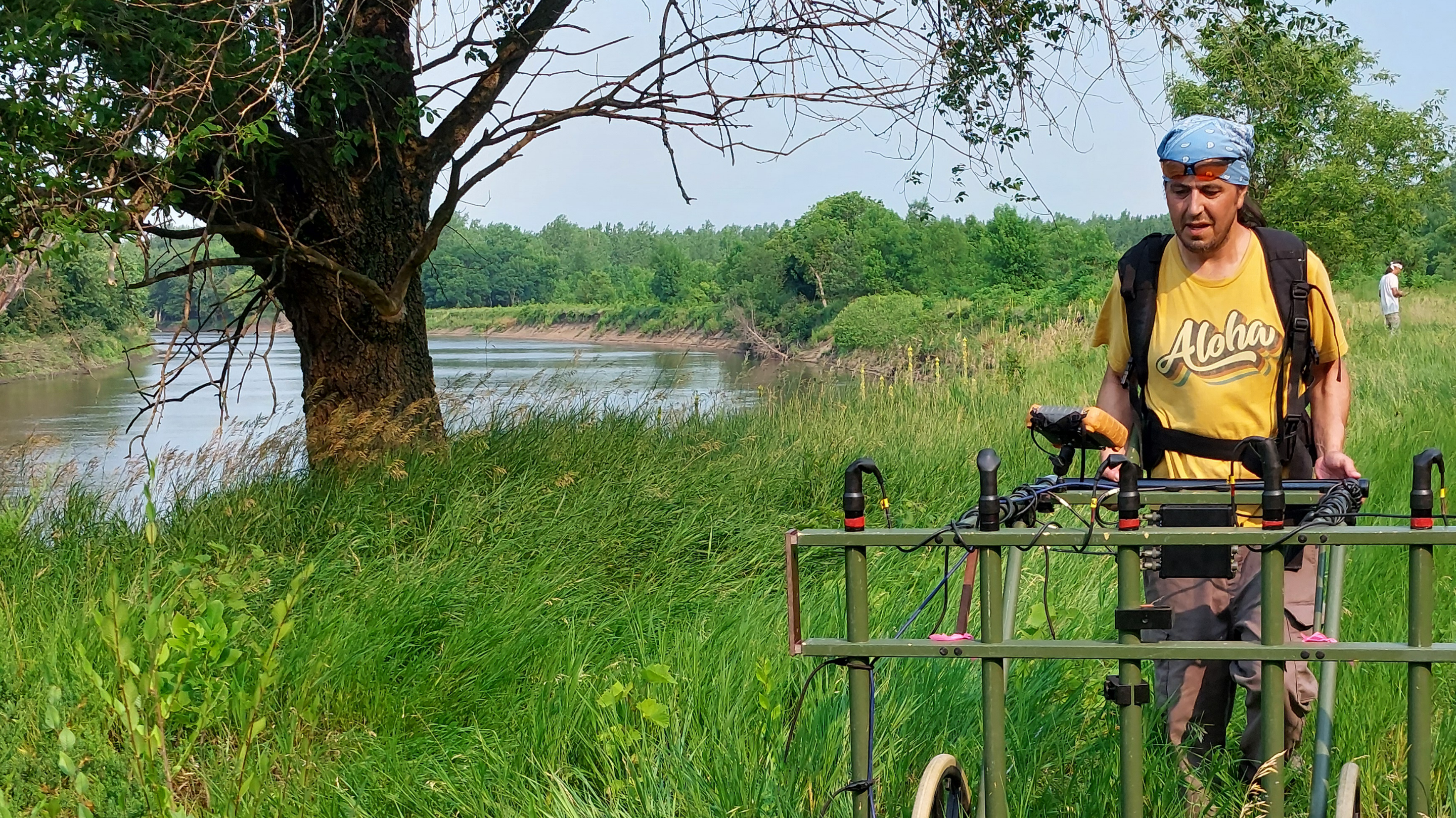
Sigrid Arnott and David Maki are museum partners at Archaeo-Physics and have just finished up a remote sensing survey (magnetometry, electromagnetic induction and ground penetrating radar) of an archaeological site near New Ulm, Minnesota. Below they describe this process and its findings.
More than 10,000 years ago, a hunter left behind a broken but elegantly worked stone spearpoint on an island that recently emerged from ebbing glacial floodwaters in the valley of the Mnísota Wakpá, or Minnesota River. Thousands of years later, around 1300 C.E., an Ancestral Dakota woman made a decorated ceramic pot to cook corn she grew on the same bottomlands. Another five hundred years passed, and, in the early 19th Century, a Dakota person saved a sherd from a glass bottle acquired in the fur trade to make a cutting edge using ancestral stone tool technology.
Similar belongings, and the workshops, kitchens, and houses they were left within lay hidden in a fallow corn field. With the increasingly extreme weather events in recent decades, riverbank erosion has cut into the site, bringing artifacts to the attention of the Science Museum of Minnesota, but erasing archeological clues about past lives.
Site management cannot proceed without determining whether intact archaeological features survive and where — a complicated endeavor since plowing has thoroughly mixed the site’s surface and heavy vegetation now covers the ground. Fortunately, the Science Museum’s archaeologists knew that a geophysical survey could help by mapping where undisturbed levels of storage pits or other features survived below the plow zone. These deep features, like time capsules, preserve the artifacts and food remains of long-lost meals and household cleanings, and offer context for finds above the surface.
Thus, the museum contracted Archaeo-Physics (AP), to complete a non-invasive geophysical survey to map potential features within the larger archaeological landscape without disturbing non-renewable cultural resources. Each method we employ responds to material contrasts between archaeological features and the natural soils that surround them. Because the properties of every site and feature are unique, we use multiple instruments to best “read” the site.
We began by examining light detection and ranging (LiDAR) data — laser scans of the Earth’s surface — to understand the site’s surface topography, and then headed to the field with equipment for sub-surface survey. To do this, we conducted a course-resolution magnetic susceptibility reconnaissance of a very large area using electromagnetic induction (EMI), followed by high-resolution surveys of smaller targeted areas using ground penetrating radar (GPR) and magnetic field gradient methods.

Magnetic susceptibility measurements can map general areas where households altered soil magnetism. Daily life in the past involved food and hide processing, meal preparation, dining, and other activities that left behind enough waste for bacteria to thrive. Some produced and left behind particles of magnetite that are considerably more “magnetic” than other naturally occurring iron oxides. These areas of human-altered soils were identified in the magnetic susceptibility reconnaissance data and used to target specific areas for high-resolution survey.
During the high-resolution portion of our survey, we verified that relying on just one method would have meant failure to “see” significant features. In sandy loam, GPR can usually map abrupt boundaries between natural soils and features such as trash pits. However, on this site, fine silt particles in the soil attenuated the signal, limiting the effectiveness of GPR survey.
Luckily, magnetic field gradient survey worked exceptionally well at this site. Magnetic surveys respond to small-scale variations in the Earth’s magnetic field. These variations can either be induced by the Earth’s magnetic field due to a contrast in soil magnetic susceptibility, or caused by thermoremanent magnetization of soils and objects such as stone, the same form of magnetism that occurs in a common refrigerator magnet. Materials with a strong remanent magnetization such as iron artifacts, fired ceramics, and igneous or metamorphic rock (including glacial cobbles) show up as strong dipoles with clear positive and negative poles. But geophysical archaeologists are trained to look for more subtle induced magnetic anomalies, like lower amplitude signals that often indicate concentrations of burned or organically enriched soils.

After checking our shoes and clothing for metal snaps, zippers, and even underwires that could affect results, we began data collection in 50 by 50-meter grids. Pushing the carbon-fiber cart with five vertical fluxgate gradiometers spaced 25 centimeters apart through heavy vegetation during a heatwave was a test of endurance, but the result was 650,000 precisely recorded readings over an area measuring 250 by 100 meters.
The high sample density — 40 readings per square meter — resulted in excellent resolution. As AP’s staff scientist processed data every evening after fieldwork, we began to see the site’s layout emerge in the form of dozens of one-to-two-meter diameter, circular magnetic “anomalies”. These subtle magnetic signals suggested that intact storage pits and hearths survived beneath the destructive zone of agricultural plowing.
To test whether our initial interpretations were correct, we chose to “ground truth” two anomalies using downhole magnetic susceptibility profiling, a minimally invasive method. Back in the field, the team located the center of the anomalies and then pushed a three-quarter inch hollow probe into both the suspected features and nearby non-anomalous control locations. Extracting a series of 25-centimeter long soil cores to a depth of 1.25 meters below the ground surface, we verified dark feature fill with ash and specks of shell extending more than a meter below surface in the anomaly cores. In contrast, the control cores transitioned to undisturbed light-brown sub-soil below the plowzone.

To quantify the physical properties of the features, we put a downhole susceptibility probe in the core holes and recorded the magnetic susceptibility levels from the bottom of the cores to the ground surface in 5 centimeter intervals. The resulting profiles documented elevated values within the anomaly cores to depths of more than one meter below surface. Our survey had correctly identified storage pits preserving contents from hundreds of years ago! Confirming our initial hypothesis allows us to interpret the remaining untested anomalies with greater confidence.
One of the confirmed magnetic anomalies (Anomaly B) was recommended for further testing by the museum’s archaeology team. Results of their testing will be shared once completed.